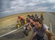
Cycling the desert from Kuryk Port to Beyneu and then onward to Nukus
Interactive Map
This interactive map and download file contains all the stops from Kuryk to Beneu and from Beyneu to Nukus. If you need more information you can click on a marker for a more detailed description. These stops/markers include water stops, places to get shade, places to eat, places to buy food and hotels.
The details were correct as of August 2018. The situation there can change so please bear that in mind when planning your journey.
Blog posts about cycling from Kyruk/Aktau to Beyneu and Nukus
You can read my account of cycling from Kuryk to Beyneu here: CYCLING FROM KURYK TO BEYNEU
You can also read my account of cycling from Beyneu to Nukus here: CYCLING FROM BEYNEU TO NUKUS
Download KML / KMZ file
Here you can download the interactive KML / KMZ file which will add the GPS points and placemarkers to your device. Suitable for Android / iphone or GPS devices. Works on Maps.me / google.maps , Google Earth and all reputable mapping software.

Additional Information
The ferry port at Aktau is no longer receiving passenger boats from Baku. This likely means that your journey will begin from Kuryk which is a new port. Developments at the port are still underway. Currently there is a hotel and a cafeteria. The nearest town is Kuryk which is at least 20km away from the port.
The stops I have marked were the only places available in 2018. The situation may have changed since then. This means that some rest stops may no longer exist (such as teahoused / chaihanas) and new ones may be available.
The best way to cycle this desert in hotter months is to create a routine where you cycle early in the morning and late in the evening, camping at night. This means that you should wake up early (around 5am) and cycle until about 11am and find a place to stop before it gets too hot. It’s best to then remain indoors for a few hours until around 5pm where cycling becomes bearable again. After that time we cycled until just before dark. We didn’t really have any idea of rest stops so I hope the map I created will help future cyclists to cross this region.
We cycled the desert in July / August which was extremely hot and temperatures in the shade got to above 45 degrees celsius. This means that in the direct sunlight, temperatures were dramatically higher than this. It is important to remain hydrated and take lots of water. For the section between Karakalpak and the next truck stop (just outside Jasliq) we took 12 litres of water each. This may have been too much given that it was cloudy, but it could easily not have been. Bear in mind that in emergencies you should flag down any passing vehicle and ask for water. People carry extra water in their cars in case of breakdown. If you are driving you should do the same.
Once you have reached the marker titled “civilisation returns” then you shouldn’t find it a problem to get food and water.
The part of the journey after Nukus towards Samarkand is considerably more populated but you still have to take care to plan your stops with good maps. It is useful to have at least two mapping softwares on your phone.
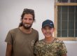
As for the journey, I really enjoyed spending time in Karakalpakia and some of the teahouses (chaihanas). But for the most part this is quite dull riding through monotonous landscape. If you are doing it alone I would recommend some good music and audiobooks.
Any questions please ask in the comments
All the best
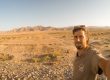
Jamie
You may also be interested in:

The Caspian Sea Ferry from Azerbaijan to Kazakhstan
The adventure of taking a cargo ship across the Caspian Sea from Alat in Azerbaijan to Kazakhstan was a lot more difficult than expected!


Thank you so much for this guide, it was invaluable for my ride across the desert in summer 2022. Things have changed a little and there was at least one extra stop available for me. I’ve written up my own experiences here: https://www.crazyguyonabike.com/doc/AktauNukus.
Thanks so much for this info! The map worked great!